Chitral
Chitral
is the beautiful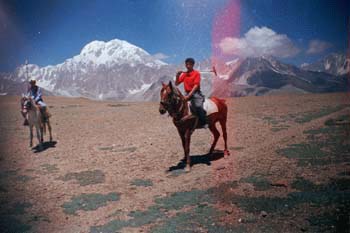 and largest valley of
NWFP.Chitral cosists of valleys high
hills and springs. The highest hill of Chitral is Trich Mir (Koh Hindu Kush). I
wrote here about the some valleys and hills of Chitral that are very important
for the tourists. Chitral,
the largest district of NWFP lies in the far north of the province. It is at a distance of 330 kilometers away from
the provincial capital Peshawar. geographically It is located at 710120 and 530
East longitude and 350 3l0and 600 550 North latitude. Nooristan and Kunar
Provinces of Afghanistan border it by Afghanistan on the North and on south by
Upper Dir district and to the West and southwest respectively. On the northeast
lies Ghizer district of Northern Areas and on the Southeast Swat district.
Ttotal area is 14850 sq.km, with a population of approximately 400,000 people.
The north and north east of the Hindu Kush range form the main water shed
between the Oxus river to its north and Yarkhun, Chitral river to its south
dividing the Afghan territories of Wakhan and Badakhshan forming the Pak Afghan
frontier on this side. To the south, the boundary Chitral and Afghanistan is
Kunar province. To the East Shandur range lies between Chitral and Gilgit. This
range is a spur of the Hindu Kush. From the Shandur pass the eastern boundary
dividing Chitral from Dir, runs along the Hindu Raj Shingara Pass. The
mountainous belt of Chitral covers 20% of the area of NWFP but it supports only
3% of NWFP's population. Cull is only 4% of total area. Grazing lands and
forests covers 20%, while the remaining 76% is covered by rocks, mountain and
snow clad peaks. Agriculture is subsistence based. Livelihoods mostly depends on
cash earnings and food grains a from outside on subsidized rates, by the
government.